





Top snowshoe hikes Chamonix
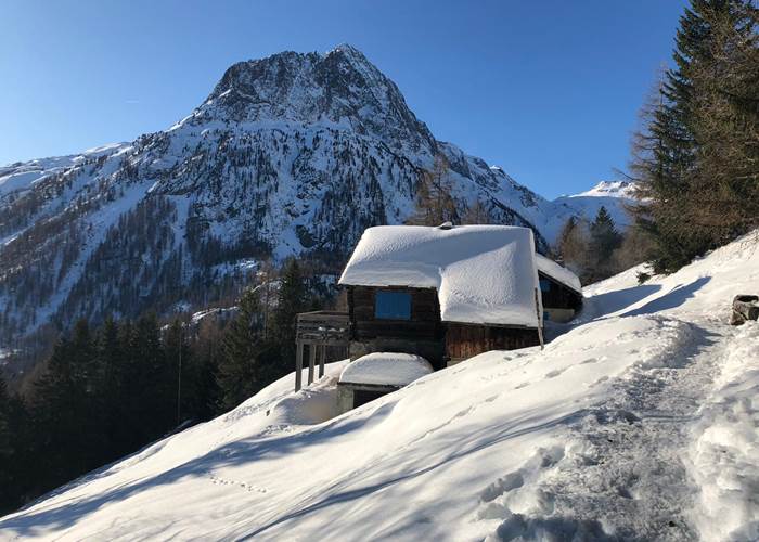
Hameau des Granges - Vallorcine
Top snowshoe hikes in Chamonix
My most beautiful snowshoe or crampon walks in the Chamonix valley, between silence, powder snow and magical views.
💡Make sure you have "Yaktrax" type crampons (to put in your bag), sometimes snowshoes are not suitable (marked, groomed paths and shallow powder snow)
Safety and precautions before departure
Snowshoeing offers access to breathtaking landscapes, but it also exposes you to a very real risk: avalanches. Even on routes considered easy, leaving the marked and groomed trails completely changes the situation. Here's what you need to know before putting on your snowshoes.
Consult the Avalanche Risk Bulletin (ARB) before each outing.
Météo-France publishes a daily Avalanche Risk Bulletin, massif by massif — the one that concerns you here is the Mont-Blanc massif. This bulletin assesses the risk on a 5-level European scale:
1 – Low risk : conditions generally safe, remain vigilant on steep slopes after recent heavy snowfall.
2 – Limited risk : possible triggering on isolated steep slopes, remain cautious on exposed terrain.
3 – Marked risk : the most frequent level in the mountains, possible triggers even with a small overload — this is where most accidents occur, as this level is often wrongly perceived as "moderate".
4 – High risk : likely triggers even with a small overload, many spontaneous avalanches possible — to be reserved for experienced professionals.
5 – Very high risk : exceptional situation, to be absolutely avoided.
I always check this bulletin before starting an outing, and I encourage you to do the same — it is available free of charge on meteofrance.com.
Safety equipment is not optional off groomed trails.
As soon as you leave a marked and regularly used route, the avalanche transceiver, shovel, and probe become essential—and above all, knowing how to use them before you need them. This equipment never replaces careful route planning, but it can make all the difference in the event of an accident.
Bring someone with you if you are not familiar with the terrain. Bring a companion if you are not familiar with the area.
The Chamonix Guides Company and several local offices offer guided snowshoeing trips, with real-time snowpack analysis — an excellent option for discovering the region safely, especially for high-altitude routes or off the beaten track.
A few simple habits, valid all season long
- Leave early, the snow warms up and becomes unstable as the day progresses.
- Avoid slopes of more than 30°, even if they appear harmless — the majority of accidents occur there.
- Never set off alone on an unmarked route.
- Always carry more warm clothing than necessary: conditions change quickly in the mountains.
- Inform someone of your route and your expected return time.
These precautions should not deter you: the vast majority of snowshoeing routes around Vallorcine and the Chamonix valley remain accessible and safe when these simple rules are respected. That is precisely the purpose of this selection — routes with their own level of risk and commitment specific to each.
To prepare your outings, feel free to consult the updated information from the Compagnie des Guides de Chamonix, La Chamoniarde (🧷visit the website) , as well as the guides available to you in my apartments.
By staying in my apartments in Vallorcine, you benefit from privileged access to the most beautiful trails in the valley while enjoying a calm and preserved environment.
Vallorcine - Argentière area:
- The Granges loop 🧡
An accessible snowshoe/crampon walk, in the heart of one of the prettiest alpine hamlets of Vallorcine. Starting from the Buet car park, then Couteray, head towards the hamlet of Les Granges, then Sur le Rocher, Fontaine Froide and La Poya — magnificent view of the Aiguille Verte, even more striking under the snow. A good route for beginners in snowshoeing, without any technical difficulty.
I highly recommend this route which I regularly use from the residence (add 1 hour round trip), with a picnic break at the hamlet of Granges.
Difficulty level: easy
Duration: 2 hours 30 minutes
Elevation gain: 250 meters
Altitude: start 1329 m, peak point: 1566 m
Avalanche risk to monitor: very localized risk after the hamlet of Granges in case of high risk, level 4.
- Les Posettes, at the top of the gondolas ❤️
A 360° panoramic view of Mont Blanc, the Aiguilles Rouges, and the Swiss mountains—accessible from the top of the cable cars in Le Tour or Vallorcine, significantly reducing the effort compared to starting from the valley. The winter colors and unobstructed views make it a beautiful snowshoeing spot. The trail is marked with fuchsia-colored posts.
Note that there are no particular difficulties, but it is a steep climb; snowshoes are essential! A magical and unmissable route, a must-do during your stay in the Chamonix valley!
Difficulty level: Intermediate / slope
Duration: 2 hours
Elevation gain: 300 meters
Altitude: approximately 2201 m
- The Chalets of Loriaz 💎
A Vallorcine classic, just as spectacular on snowshoes as in summer—the alpine chalets under the snow, with the Mont Blanc massif as a backdrop, offer a completely different atmosphere than the summer season. Starting point: Couteray. Please note, this route is more challenging than the previous one and is recommended only for snowshoers with some experience.
⚠️Departure and return via Couteray (no return via Siseray, avalanche corridors!)
This route is, in my opinion, the best in the Chamonix valley. I recommend stopping at the refuge for lunch (open from mid-December to mid-April, book well in advance!).
Difficulty level: Difficult
Duration: approximately 5 to 6 hours for the round trip
Elevation gain: +700 m
Altitude: up to approximately 2020 m
Avalanche risk to monitor: Loriaz Plateau should be avoided due to high avalanche risk (level 4)
- Crossing the Col des Montets ⭐
⚠️To be carried out when the avalanche risk is low and when the snowpack is well stabilized!
A snowshoeing route from Vallorcine to Argentière that connects two valleys via the Col des Montets pass—a spectacular route, with a completely different landscape once the snow has settled, winding through snow-covered larches and offering views of the peaks. It's a traverse (not a loop), so plan your trip with the return journey in mind, perhaps by taking the Mont Blanc Express train back to Argentière.
Difficulty level: Intermediate
Duration: 3 hours
Elevation gain: 200 m
Altitude of the pass: 1461 m
Avalanche risk to monitor: to be avoided if avalanche risk is level 3 or 4.
- Small south-facing balcony: Argentière – Les Tines
Panoramic balcony with minimal elevation change. Numerous viewpoints overlooking the Mont Blanc massif. Return possible via the Mont Blanc Express train
Difficulty level: easy (valley bottom)
One-way journey time: 2 hours
Elevation gain: +200
Altitude: from 1080 m to 1270 m
Avalanche risk to monitor: avoid at avalanche risk level 4. Check risk level 3.
Chamonix area:
- Snowshoeing route of the index finger 🤩
A beautiful marked loop trail with views of the Mont Blanc massif from the top of the Index chairlift at 2396m. On the right, towards La Floria, follow the marked loop trail. Enjoy the breathtaking views of the Mer de Glace glacier and the Grandes Jorasses peaks.
Difficulty level: easy
Duration: 1 hour
Elevation gain: 150 m
Altitude: 2500 m
- The Hat Chalet 👌
Viewpoint overlooking the Mer de Glace, the Arveyron Gorges, the Aiguilles and the Chamonix Valley. Departure from Lavancher (parking).
⚠️Crossing the waterfall is subject to the threat of avalanches.
A wonderful and delightful time at the Chapeau refreshment stand (open depending on the weather), I highly recommend it!
Difficulty level: Intermediate
Round trip duration: 3 hours
Elevation gain: 500 m
Altitude: from 1050 m to 1600 m
Avalanche risk to be aware of: avoid this area when avalanche risk is level 3, or during a significant thaw (end of winter). Get all the information you need in case of level 2 (call the Chamoniarde and the refreshment stand at the Chapeau).
- Small southern balcony: Les Tines - Chamonix
Panoramic balcony with a slight slope. Numerous viewpoints overlooking the Mont Blanc massif. Return possible via the Mont Blanc Express train
Difficulty level: easy (valley bottom)
One-way journey time: 2 hours
Elevation gain: +200
Altitude: from 1080 m to 1270 m
Avalanche risk to monitor: avoid at avalanche risk level 4. Check risk level 3.
Houches area:
- The chalets of Charousse 🏚️
Magnificent views of Mont Blanc and a grand setting at the chalets of Charousse.
Start: Parking at Prarion Les Chavants, right next to the pretty lake of Chavants then towards the chalets of Charousse, out and back walk, or loop.
A visit is possible in case of heavy snowfall.
A real gem and a site steeped in history, an easy walk to do with the family!
Difficulty level: Easy
Round trip duration: 2 hours
Elevation gain: +200
Altitude: from 1,000 m to 1,200 m
- Snowshoeing route on the Prarion plateau (La Charme) 🤩
Exceptional 360° panorama! From the top of the Prarion gondola, this superb loop winds its way across the Charme plateau, offering panoramic views of the Mont Blanc massif, the Fiz mountain range, the Aravis range, and the Val Montjoie valley. It can be combined with the Petit Prarion loop.
Access is mandatory via the Prarion gondola lift with a return ticket. Check with the ticket offices before entering the area for conditions.
Difficulty level: Easy
Round trip duration: 2 hours
Elevation gain: +150
Altitude: 1850 m
- Snowshoeing trail of Petit Prarion
Perched at around 2000 meters altitude, this short loop offers no less than a spectacular view from the Tête du Petit Prarion.
Difficulty level: Easy
Round trip duration: 1 hour 30 minutes
Elevation gain: +150
Altitude: 1900 m
Chez Charles**** | Vallorcine Viachamonix
One Visit Is Never Enough
Rental of 4-star apartments in Vallorcine, in a residence with an indoor pool, sauna, steam room, and Jacuzzi – gondola lift 50m away